Contact us
Discover how SAR data and space systems can help your organization achieve mission success. Reach out to our experts today.
News Article
Cloud cover, polar night, and decades of trade-offs have kept the world’s most critical regions persistently undermapped.
When a disaster strikes, one of the most critical questions is also one of the simplest: what changed? Whether it’s floodwater spreading across a river basin, a landslide reshaping a hillside, or coastal erosion quietly eating away at a shoreline, the ability to detect and measure change depends on having a reliable picture of what was there before.
That “before” picture is a basemap — a high-resolution image of the Earth’s surface collected under consistent conditions so it can serve as a reference point. Basemaps are foundational to how mapping agencies, emergency managers, insurers, and defense organizations understand and monitor the world. But keeping them current at state or national scale has been one of the hardest, most resource-intensive problems in Earth observation.
This is the first in a three-part series exploring how routine SAR basemap production is changing what’s possible. We’ll start with the problem itself: why basemaps have always been so hard to build and maintain, and what the cost of that difficulty looks like in practice.
At any given moment, roughly two-thirds of the Earth’s surface is obscured by cloud. Over the Arctic Ocean, that figure exceeds 90%. In parts of Alaska, clear skies occur as few as 10 days per year. In the tropical forests critical to climate monitoring, cloud cover persists more than 80% of the time. Some locations in the Amazon can go entire years without a single usable optical satellite image.
These aren’t edge cases. They’re the baseline conditions in the regions where up-to-date mapping matters most — for disaster response, climate adaptation, infrastructure planning, and national security. And they represent a fundamental constraint that no optical satellite, however capable, can overcome. More than half of all optical satellite passes globally fail to produce imagery usable for basemap production.
Synthetic Aperture Radar has been a primary source for basemap imaging for decades, and for good reason: SAR sees through clouds and works day or night, making it a backbone for persistent, repeatable Earth observation. Missions like the European Space Agency’s Copernicus Sentinel-1 have provided SAR basemap coverage that serves users worldwide.
But traditional SAR missions force a trade-off. You can have coarse resolution — typically 10-meter pixels or larger — with reasonable revisit times, or you can have higher resolution at the cost of coverage speed. Building a high-resolution nationwide basemap with conventional SAR missions can take months or even years. By the time the map is complete, the earliest images in the mosaic may already be outdated.
For users who need current, consistent basemaps to support change detection, disaster response, or long-term environmental monitoring, this has been a fundamental constraint. The data was either too coarse to be actionable, or too slow to be timely.
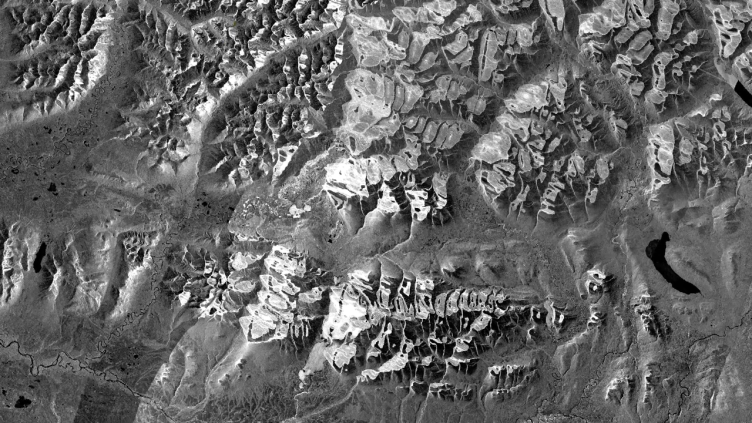
Alaska is the most instructive case study in why basemap creation has been so hard. The state spans more than 1.7 million square kilometers of remote, weather-affected terrain — one-fifth the area of the contiguous United States. Yet much of it had never been mapped to national standards, at any scale, until the last decade. Previous elevation data came from digitized contour maps based on poorly controlled 1950s aerial photography. Some of the data being used for planning and safety decisions was 70 years old.
When Alaska finally received modern mapping, the technology chosen was not optical but airborne interferometric SAR (IfSAR) — specifically because radar was the only technology that could penetrate the persistent cloud, smoke, and haze that defeated conventional methods. The campaign took 10 full years, cost $66.3 million, and required coordination across 15 federal and state agencies. It was completed in 2020.
That’s the scale of the problem: a decade-long, multi-agency ordeal costing tens of millions of dollars to map a single state once. And it produced a static dataset — a one-time snapshot, not a continuously updated baseline. The moment it was finished, it began aging.
A decade and $66.3 million to map Alaska once. The result was already aging the day it was finished.
But what would it look like if that kind of coverage weren’t a one-time achievement, but a routine operation? If the “before” image was always ready — and always improving?
→ Part 2: “From Decade-Long Ordeal to Routine Operations”
→ Part 3: "From Baseline to Action: What Routine SAR Basemaps Make Possible"
ICEYE US equips U.S. government agencies, defense contractors, and commercial enterprises with access to timely, reliable, and actionable persistent monitoring. Leveraging the world’s largest constellation of advanced synthetic aperture radar (SAR) satellites, we deliver critical insights—anywhere on Earth, regardless of weather or light conditions.
Driven by innovation and a commitment to national security, ICEYE US is a trusted partner in addressing complex challenges, from disaster response and defense operations to environmental change and scientific discovery. Our state-of-the-art solutions enable decision-makers to act with confidence in safeguarding lives, infrastructure, and assets. Based in the heart of Southern California’s defense-tech innovation hub, ICEYE US is a mission-focused, technology-driven organization, pushing the boundaries of what’s possible in Earth observation.
Learn more at www.iceye.us
Media Contact: Alison Patch, Director of Communications
alison.patch@iceye.usGet the latest news and updates from ICEYE US directly to your email. Don't forget to follow us on LinkedIn. For press inquiries and further materials please refer to our News section.