Contact us
Discover how SAR data and space systems can help your organization achieve mission success. Reach out to our experts today.

Use case: Environmental Security
Monitor forests to prevent unauthorized deforestation with the world's most reliable data – around the clock and in any weather.

Shay Strong, VP - Analytics / ICEYE
Deforestation jeopardizes the livelihood of millions and accounts for approximately 10% of global carbon emissions. Illegal logging is a global problem: forests are cut down for unregulated timber sales, and farmers are clearing out land for agriculture and cattle ranching. Activities like this can be hard to detect with conventional methods.
With the ability to see through darkness, clouds, or fog, and to frequently monitor vast areas, SAR imagery from ICEYE US is perfectly suited for persistent monitoring of deforestation. Get the information you need for mapping and measuring forest loss, taking timely action against illegal deforestation, planning reconstruction activities, analyzing the impact on carbon emissions, and more.
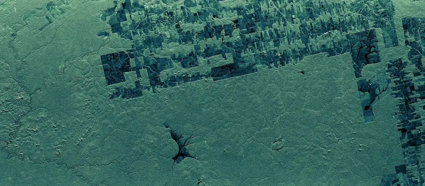
Clear cuts in North Kalimantan Province, Indonesia. SAR data enables early detection of new paths in the forest. Deforestation site often starts with a straight line, cutting deep into the forest. This path is then usually expanded into a rectangle with clear cuts. Such line can also indicate building of new roads, airstrips or illegal mining sites organized in the forest areas.
Unauthorized mining and other illegal activities in rainforests can be highly difficult to detect when they are covered by a dense forest canopy.
SAR satellite data from ICEYE US enables the detection of forensic-level changes and activities in large areas, anywhere on the planet.
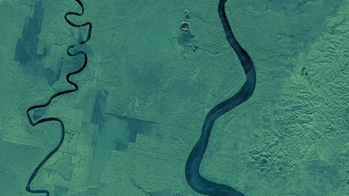
ICEYE US SAR imagery showing changes in the forest structure of the Brazilian Amazon Forest. SAR imagery is perfectly suited to analyze various changes in forest structure at nighttime, through clouds, fog, and smoke.
Forest fires, both accidental and intentional, are causing increasingly severe damage year after year. Even when they do not destroy the affected areas, they make forests less resilient to future damage and threaten their ability to capture and store carbon.
With the world’s largest SAR satellite constellation, ICEYE US enables you to monitor wide forest areas for possible wildfires, around the clock and in any weather, and to respond to them quickly.
Download our Application study to learn how to use ICEYE US SAR data to monitor deforestation anywhere in the world.
Detect suspicious activities.