Contact us
Discover how SAR data and space systems can help your organization achieve mission success. Reach out to our experts today.

What We Do
We deliver relentless readiness for national, economic, and environmental security by equipping U.S. government decision-makers with uninterrupted access to critical insights via space-based monitoring.

Eric Jensen - CEO of ICEYE US
Our Technology
ICEYE US SAR satellites are smaller, more cost-effective, and offer greater flexibility compared to older, traditional systems. We cater to an extensive range of security applications by integrating a miniaturized SAR sensor onto a flexible, high-performance and lightweight platform, ICEYE US satellites offer extended imaging durations at exceptionally high resolution, the ability to scan over wide areas, and frozen orbit monitoring.


Dwell modes help extract unmatched critical information from a single image. See every detail in incredible clarity with enhanced image quality and reduced noise. Dwell Precise, the industry's highest fidelity 25 cm imaging product, is the latest addition to the Dwell family.
Ground resolutions: 25 cm, 50 cm, and 1 m
Scene size: 5 km x 5 km
Spot enables very high resolution (up to 50 cm) and the largest available scene size for detailed monitoring. Use Spot modes for object identification and highly detailed change detection.
Ground resolution: up to 50 cm
Scene size: up to 15 km x 15 km
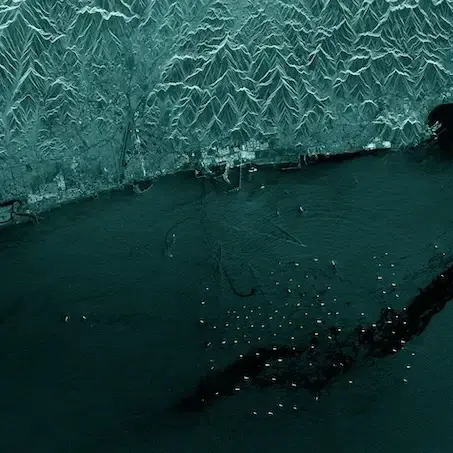
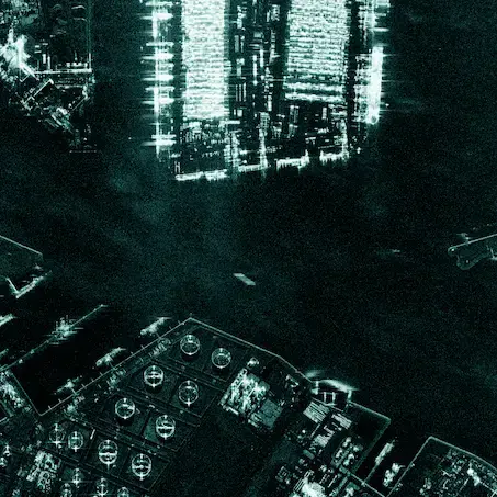
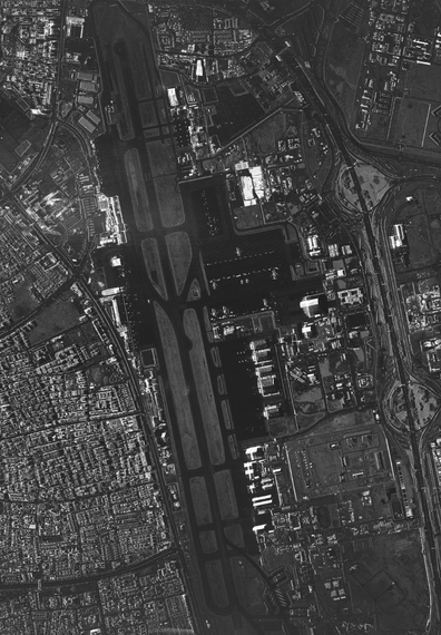
Strip is perfect for detecting changes to vast sea and land areas. Use Strip mode to see and respond to natural disasters and illegal activities, and to persistently monitor borders, coastal areas, or any location of interest.
Ground resolution: 3 m
Scene size: 30 x 50 km
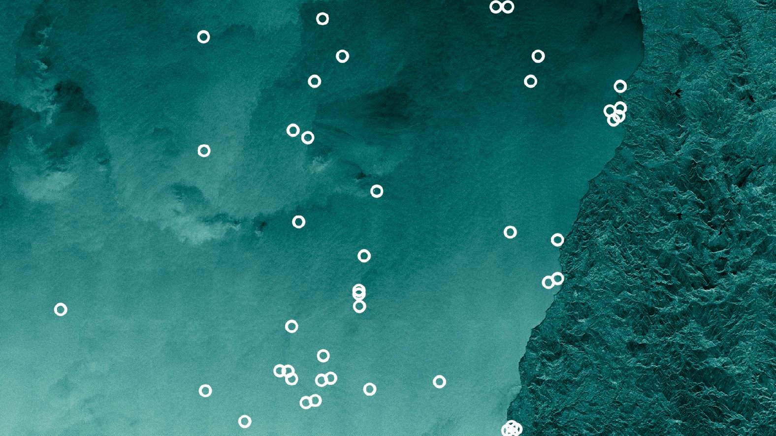
Scan can cover an area of up to 840 km by 100 km. Scan mode is particularly effective for acquiring wide coverage imagery for maritime use cases, where national security authorities and maritime safety officials need persistent visibility.
Ground resolution: 15 m
Scene size: 840 km x 100 km

Our radar sensors deliver data products with high reliability, excellent quality, frequent revisit and rapid dissemination. From strategic to tactical decision-making, maritime observation to specific site monitoring, find out how our data creates confidence.
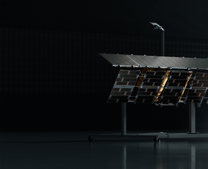
From our production line to your mission. Our innovative, vertically integrated space and ground systems create opportunities for unique applications.
Maintain continuous awareness with all-weather, day/night collection capabilities delivering reliable, high-quality data regardless of time of day, cloud or ash cover, darkness, or other adverse conditions.
From strategic surveillance with 25cm resolution, to tactical planning based on hundreds of square kilometers collected at 1m resolution, to maritime search with medium resolution applied to tens of thousands of square kilometers, our products are designed to match applications with every collection.
Unprecedented global coverage and industry-leading revisit capabilities through our unrivaled constellation of synthetic aperture radar (SAR) satellites. Access any location on Earth in hours, receive data in minutes for critical decision-making.
Our expertise in advanced phased array technology provides our customers with the cost, schedule and performance advantages they need to achieve mission success.
Maritime awareness, infrastructure monitoring, border security, counter-trafficking
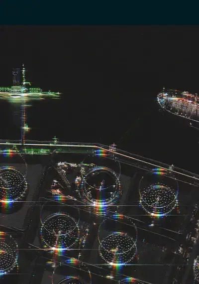
Supply chain monitoring, port security, resource management, illegal fishing detection

Climate research, disaster response, environmental impact, Arctic monitoring

junio 10, 2026
11 min read
From Copper Mine to Critical Infrastructure
The Case for Persistent SAR Monitoring Across the Mining Lifecycle
Read the post From Copper Mine to Critical Infrastructure →
junio 2, 2026
2 min read
ICEYE US Appoints Ann Stevens as Chief Executive Officer
National Security Veteran to Lead U.S. Space Intelligence Company Irvine, CA, June 2, 2026 — ICEYE US, a leading American commercial Earth ...
Read the post ICEYE US Appoints Ann Stevens as Chief Executive Officer →
mayo 14, 2026
2 min read
ICEYE US Awarded Contract Under National Reconnaissance Office Strategic Commercial Enhancements Program
NRO selects ICEYE US as a commercial space-based intelligence provider under flexible acquisition vehicle designed to rapidly integrate ...
Read the post ICEYE US Awarded Contract Under National Reconnaissance Office Strategic Commercial Enhancements Program →