Contact us
Discover how SAR data and space systems can help your organization achieve mission success. Reach out to our experts today.

Persistent, actionable information is at the heart of decisiveness.
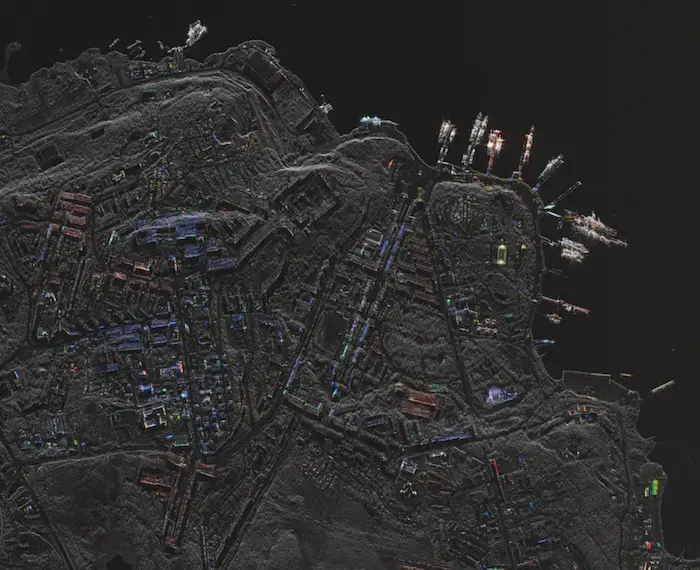
Our radar sensors deliver data products with high reliability, excellent quality, frequent revisit and rapid dissemination. From strategic to tactical decision-making, maritime observation to specific site monitoring, find out how our data creates confidence.
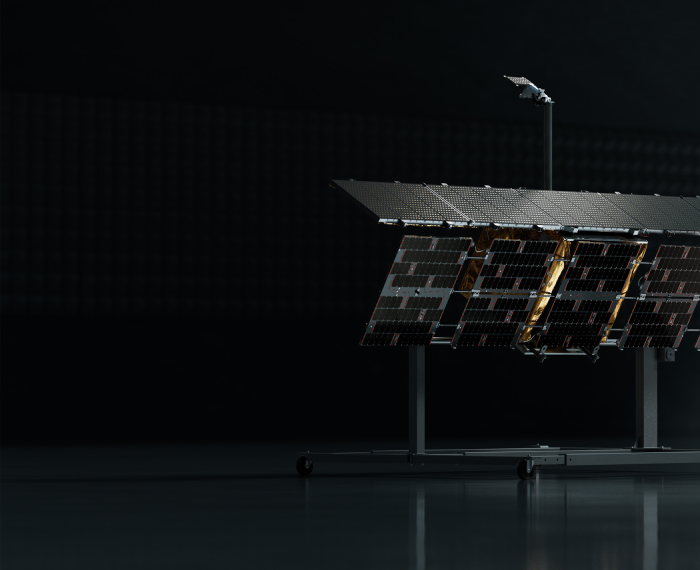
From our production line to your mission. Our innovative, vertically integrated space and ground systems create opportunities for unique applications.

11 min read
From Copper Mine to Critical Infrastructure
The Case for Persistent SAR Monitoring Across the Mining Lifecycle
Read the post From Copper Mine to Critical Infrastructure →
2 min read
ICEYE US Appoints Ann Stevens as Chief Executive Officer
National Security Veteran to Lead U.S. Space Intelligence Company Irvine, CA, June 2, 2026 — ICEYE US, a leading American commercial Earth ...
Read the post ICEYE US Appoints Ann Stevens as Chief Executive Officer →
2 min read
ICEYE US Awarded Contract Under National Reconnaissance Office Strategic Commercial Enhancements Program
NRO selects ICEYE US as a commercial space-based intelligence provider under flexible acquisition vehicle designed to rapidly integrate ...
Read the post ICEYE US Awarded Contract Under National Reconnaissance Office Strategic Commercial Enhancements Program →